BETA PROJECT · OPEN DATA
MIL·AIR Radar — a live air-picture map built from open sources
A lightweight radar app that shows military aviation, air-raid alerts and reported threats from public monitoring channels in real time — on one map, identical for every viewer. Now in open beta.
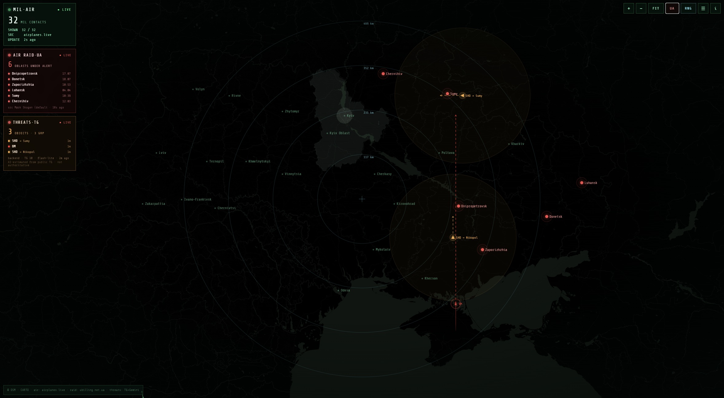
The MIL·AIR Radar interface: contacts, velocity vectors, oblast-level alerts and threat tracks.
What it is
MIL·AIR Radar is a single HTML page that runs in any browser, on desktop and mobile. No app, no registration, no stored history. Open the page — you see the current picture; close it — nothing remains.
The project was inspired by mapa.ua — a great map, but I needed a much lighter version: something that runs comfortably even on a Raspberry Pi, shows only the real-time picture, and skips history and everything else that adds weight.
Where the data comes from
▲ Military aviation
Live ADS-B transponder data for military-tagged aircraft from open exchanges (airplanes.live, adsb.fi, adsb.lol). Updated every few seconds: position, course, speed, altitude, velocity vector and flight trail.
● Air-raid alerts
Oblast-level air-raid alert status for Ukraine from a public aerial-alerts API, refreshed roughly every 20 seconds.
▲ Threats (Telegram + AI)
Every 3 minutes, the server reads open public Telegram monitoring channels. An AI model merges the reports into a set of tracked objects with estimated position, course and speed. Between updates, positions are extrapolated on the server, so every viewer sees the same picture: solid line — path taken, dashed line — projection. Shahed-type contacts show a translucent one-hour reach circle.
Sources
Telegram monitoring channels (open, public):
@kpszsu · @Ukrainian_Intelligence · @kudy_letyt · @raketa_trevoga · @StrategicaviationT · @avimonitor · @strategicontrol · @war_monitor · @povitryanatrivogaaa · @UkraineAlarmSignal
Other data sources:
- ADS-B aircraft feeds: airplanes.live, adsb.fi, adsb.lol
- Air-raid alerts API: ubilling.net.ua aerial alerts
- Map tiles: OpenStreetMap · CARTO
- Inspiration: mapa.ua
What it can do
- velocity vector and trail for every contact, icons rotated to heading;
- threat track for the last 20 minutes plus a movement projection;
- oblast-level air-raid alerts in real time;
- hover for a data card, click to pin an object;
- range rings, Ukraine territory highlight, switchable base map;
- mobile mode — panels collapse behind the ☰ button.
Status: beta
The project is in open beta. Inaccuracies, delays and recognition errors are possible. Feedback is very welcome — what displays incorrectly, what is missing, what gets in the way.
DISCLAIMER
This is an unofficial visualisation of open public data. Threat positions are approximate AI estimates based on crowd-sourced reports: they can be inaccurate, incomplete or delayed. Never use this map for personal-safety decisions — follow official air-raid alerts and civil-defence instructions.
Open the radar → Leave feedback
TAGS
#повітряна_тривога #мапа_тривог #радар #шахед #ракетна_небезпека #куди_летить #моніторинг #повітряний_простір #ППО #балістика #мапа_загроз #військова_авіація #ADSB #відкриті_дані #Україна #тривога_онлайн #повітряна_обстановка #бета